

Cumulative Impacts
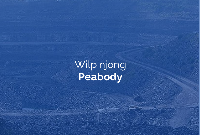
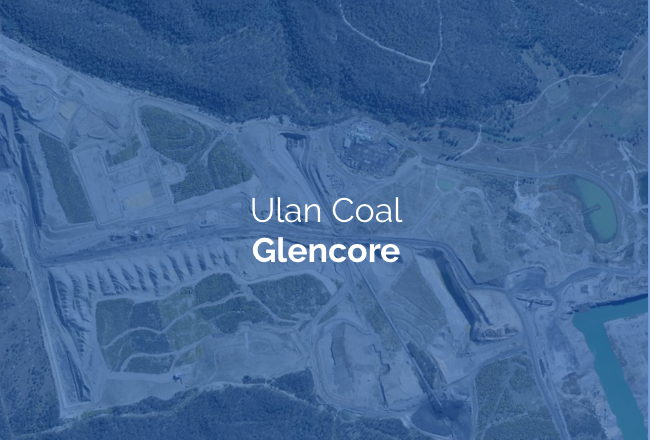
The maps above show two different pictures of coal mining activity north of Mudgee. The first shows current Mining Leases (ML) - the approved, active footprint of Wilpinjong, Moolarben and Ulan coal mines.
The second shows Exploration Licences (EL): the areas where coal companies hold the right to explore for future mining. Together, they reveal what the planning system has never properly confronted – the broadscale impact of coal mining across this catchment. That these mines form, in effect, a single ‘super-mine’ that has significant consequences for the communities, catchments and ecosystems surrounding it.
Cumulative impact refers to the combined effect of multiple activities on a shared environment over time. In the context of coal mining north of Mudgee, it means asking not just "what does this mine do?" but "what do all three mines do, together, to our water, our land, our wildlife and our future?" These three mines straddle the Great Dividing Range, affecting catchments to both the east and the west. They share the same ancient Triassic groundwater system that feeds the Goulburn River and The Drip. Since the 1990s they have collectively extracted over 200 gigalitres of groundwater – roughly 40% of Sydney Harbour. Dewatering extends the zone of impact up to 20 kilometres beyond the visible mine boundary. They have collectively cleared over 3,000 hectares of native vegetation and disturbed more than 6,000 hectares of land. And yet no cumulative assessment of all three mines has ever been required by the NSW Department of Planning, Housing and Infrastructure. No consideration of intergenerational cost is being factored into any of these approvals.
A genuine cumulative assessment would require the three mining companies to collectively model and account for their combined impact on shared resources and natural systems - across the full life of operations and into the future. It would require a shared baseline of environmental data before further approvals are granted, independent monitoring of groundwater, surface water, biodiversity and air quality across the entire region, and binding obligations on all three operators to respond to cumulative findings. It would require the NSW Government to treat this landscape as a single interconnected system - not as separate projects assessed in isolation.
Wiradjuri cultural heritage:
This is an ancient and culturally sensitive site.
The headwaters of the Goulburn River (where these mines are located) is the lowest point of the Great Dividing Range. This beautiful area has been a well-used trading route and gathering place for the Wiradjuri people for millenia and continues to hold great spiritual and cultural significance.
Evidence of Wiradjuri occupation such as artefact scatters and cave shelters have been identified in mine company investigations, and Heritage Management Plans have been developed. These plans accept that impact will occur.
The cumulative impact and loss of value to the Wiradjuri people is shameful. The total loss is unacknowledged and immeasurable. As a community, we are diminished by this destruction.
“The destruction of yet more known Aboriginal sites is indefensible. The Wiradjuri nation has endured an on-going loss of culture and connection to country through the impact of the contiguous mines along the Goulburn River. The immediate expected impact from this proposal must be included in a cumulative assessment of the Ulan, Moolarben and Wilpinjong mines... Indigenous sites and cultural heritage have been undervalued for too long. That heritage is often destroyed due to mining activities with many ‘small’ losses occurring across numerous sites, adding up to a huge overall loss. We are diminished by decisions that allow this desecration.”
– Rosemary Hadaway, MDEG

Water
All three mines intercept and extract surface and groundwater from the Goulburn River catchment. This draws down local and regional aquifers including the Triassic groundwater system that supplies base flows to the Goulburn River, the surrounding groundwater dependent ecosystem (GDE) and The Drip. The Drip, a permanent water feature in the Goulburn River National Park, has survived every recorded drought since 1915.
Coal mining requires constant dewatering of underground and opencut operations that lower (depressurise) the water table. Each new expansion extends the drawdown footprint further and for longer. Glencore's own consultants have modelled impacts on the Triassic groundwater system extending 100 to 3,000 years post-mining before a groundwater ‘equilibrium’ is reached, lowering the groundwater levels by 10-100 metres. The cumulative and long-term impacts of Wilpinjong, Moolarben and Ulan on the groundwater system has not been adequately considered or assessed. The resulting dewatered landscape has an increased risk of wildfire and reduced resilience to drought. The Upper Talbragar and Goulburn River catchments – which supply water to the east and west of the Great Dividing Range - are being progressively and irreversibly altered. This is not a future risk. It is happening now, and nobody is being held to account.
Groundwater drawdown and mine water discharge
The total licensed ‘groundwater take’ by coal mines in the Ulan Wollar area exceeds 24,000 million litres per year (24 GL). The drawdown of groundwater levels, intercepted and extracted during mining has consequences, it does not simply disappear. Some of this water is used for washing coal or dust suppression, some partially treated by reverse osmosis (RO plant), most is discharged into the Goulburn River.
Mine water discharge is contributing a significant salt load to the Goulburn and Hunter Rivers. The three mines are granted Environment Protection Licences (EPL) authorising daily discharge (with limits on some pollutants) into the headwaters of the Goulburn River catchment. The combined licenses permit the export of up to 28 tonnes of salt per day in the discharge water - more than 10,000 tonnes salt per year -[1]
- Ulan Coal Mine (EPL394): licensed to discharge 30 ML/day at up to 900 µS/cm — approximately 18 tonnes of salt per day
- Moolarben Coal Mine (EPL12932): licensed to discharge up to 20 ML/day at 619 µS/cm — approximately 8.4 tonnes of salt per day
- Wilpinjong Coal Mine (EPL12425): licensed to discharge 6.5 ML/day at 500 µS/cm — approximately 2.2 tonnes of salt per day
These licensed discharges do not include passive seepage of saline groundwater from disturbed mining areas, which is unmeasured, or the saline concentrate from reverse osmosis water treatment disposed into disused open cut pits.
The salt load travels 225-kilometre length of the Goulburn River before entering the Hunter River system. While the Goulburn River is the Hunter's largest tributary, it is not included in the Hunter River Salinity Trading Scheme - meaning there is no cap, credit system or enforceable limit on the cumulative salt discharge from these three mines into the Hunter River.
Research investigating the contribution of mine discharge to salt loads at the mid-catchment Coggan gauging station (Imrie 2019) found that the salt yield from just Glencore’s Ulan Coal Mine Mine’s contributed 13.3% of the total salt load in the river between 2012 and 2016. Salt yield per square kilometre from the mine was more than ten times higher than the surrounding catchment, and six times higher than comparable Goulburn River tributaries.
Post-mining this problem will continue with four open cut pits currently approved to remain permanently in the catchment. Water quality in some pits is predicted to eventually exceed the salinity of seawater, requiring active management for many generations. As water table rises salts, heavy metals and organic compounds are mobilised from the disturbed mining footprint. This represents a long-term hazard to water quality — particularly during the extreme rainfall events that climate change is making more frequent and intense.
The connection between the lowering of groundwater, mine water discharge and river health is not theoretical. The depletion of freshwater aquifers and changes to the river flow regime have permanently reduced baseflows that sustain the river ecosystem during drought periods, and increased algae blooms and salty deposits along the banks and river bed. The far-reaching consequences of these impacts on the water system post mining, has not been appropriately assessed by industry or government.
[1] Estimate of daily salt load S (tonnes/day) based on relationship between measured EC (Electrical Conductivity) and TDS = a. EC x 0.68 x Q(ML) x 10-3.
Cumulative Footprint
The three mines' current approved mining leases cover approximately 300 km² of the upper Goulburn catchment. Exploration licences over a further 165 km² would extend this footprint if current and proposed expansions proceed to 2041. The open cut footprint is concentrated in the valley floor - in the natural recharge, discharge and alluvial areas most critical to the health of the river and its dependent ecosystems.
No comprehensive independent assessment of the cumulative hydrological impacts of all three mines on the Goulburn catchment has ever been undertaken. Every expansion continues to be assessed mine by mine, modification by modification. The true scale of cumulative water loss, salt loading and groundwater depletion across this shared river system has never been required to appear in a single document. As with clearing, subsidence and emissions, we have compiled these figures ourselves - because the planning system has never been required to add them up.
Clearing
Coal mining begins with clearing. Before a single tonne of coal is extracted, native vegetation is stripped, topsoil is removed and habitat is destroyed. Across Wilpinjong, Moolarben and Ulan, 3,068 hectares of native vegetation has already been approved for clearing, with a further 287 hectares proposed across the three current mine expansions.
This vegetation is not interchangeable. The woodlands north of Mudgee include Box Gum Grassy Woodland – a critically endangered ecological community – and critical habitat for threatened species including breeding Regent Honeyeater, Large-eared Pied Bat and Koala populations. The NSW Koala Strategy and BDAR recognises the habitat as “critical to the survival of the local population”, and that the “Project may result in increased mortality/physiological stress of the species”. Each expansion clears another fragment. The Koalas, Microbats and Woodland birds displaced by one mine cannot simply relocate to the next, because the next mine is clearing too.
This is the pattern that cumulative assessment exists to catch and that the current framework misses entirely. Each modification assesses the habitat value of its own footprint in isolation, against its own offset obligations, as though the surrounding landscape were intact. But the surrounding landscape is three contiguous mines progressively clearing the same shared habitat. The true measure of impact is not 287 hectares here or a few hundred there – it is the steady erosion of a connected ecosystem, assessed one disconnected piece at a time. Offsets cannot manufacture replacement habitat of equivalent ecological significance or connectivity, and they cannot account for the cumulative fragmentation that pushes threatened species past the point of viability.
The full extent of land disturbance compounds this loss. 6,013 hectares of surface disturbance has already been approved across the three mines, with a further 1,037 hectares proposed. Surface disturbance is the total footprint disrupted by mining activity – clearing, excavation, infrastructure and rehabilitation areas. Like every other impact in this catchment, it has only ever been assessed mine by mine, modification by modification. The regional total – the actual scale of what is being lost – appears in no single assessment document. We have compiled these figures ourselves, from the three mines' own assessment documents, because the planning system has never been required to add them up.
Subsidence and mine disturbance
Underground longwall mining causes the land above it to subside as coal panels are extracted and the rock above collapses. Depending on the depth of cover, cracking can extend to the surface. The Ulan and Moolarben mines north of Mudgee include underground operations, with multiple longwall panels approved, operating and proposed across the region.
The mines also contain significant open cut disturbance; An open cut mine is a method of extraction that involves removing all the soil, rock and vegetation above a deposit to excavate it from the surface, rather than tunnelling underground.
Subsidence and open cut mining can alter surface drainage, crack and collapse cliffs, destroy cave networks, damage infrastructure, affect groundwater flow pathways and permanently change landform. Across the Ulan and Moolarben underground operations, 9,357 hectares of subsidence impact has already been approved, with a further 2,368 hectares proposed through Ulan Mod 6 and Mod 8 alone. As with every other impact, individual modification assessments consider subsidence only within a mine's own boundary – the regional picture remains largely unexamined.

Climate Change
NSW's own Net Zero Commission has stated that no new coal projects can be approved if the state is to meet its commitments under the Climate Change (Net Zero Future) Act 2023. Despite this, the NSW Department of Planning has consistently failed to require cumulative emissions assessments across the three mines that its own guidelines demand. The guidelines exist. They simply are not being enforced.
Total Product Coal 3 mines = 39.9 MT in 2025 reporting year
A landmark 2025 NSW Court of Appeal ruling has established that this must change. In a unanimous decision in July 2025, the Court found that planning authorities are legally required to consider the specific local climate impacts of a project's downstream emissions – not just their global contribution to warming. The ruling found that decision-makers must consider the negative impacts that greenhouse gases resulting from a development will have on the environment and communities in the local area. The case, brought by the Hunter Valley community group DAMSHEG, successfully challenged the expansion of the Mount Pleasant coal mine. MACH Energy is now appealing to the High Court.
This precedent has direct relevance for Mudgee. The climate impacts of three large coal mines on a region that is already experiencing more intense droughts, more variable rainfall, higher temperatures and escalating bushfire risk – and whose ancient groundwater systems are already stressed – have never been specifically assessed in any approval process. Climate change also compounds the water impacts described above: higher evaporation rates, more intense dry periods, and reduced groundwater recharge compound the drawdown already caused by mining. These are local climate impacts. Under the Court of Appeal's ruling, they must now be considered.
Economy and Workforce
The coal industry's economic contributions to the Mudgee region are real and we do not dismiss them. However, there is a significant double standard embedded in how these contributions are assessed. When individual mine modifications are assessed for their environmental and water impacts, the assessment is limited to the specific modification – the new pit, the new longwall panels, the extension. Cumulative environmental impacts are explicitly excluded. But when the same mines are required to demonstrate their economic benefit, they routinely cite the employment and economic output of the entire mine complex – including workers and activity from operations approved decades ago. This produces inflated employment figures that bear no relationship to the jobs actually created by the modification being assessed. It is a convenient double standard: environmental accountability is siloed; economic credit is cumulative. A genuinely fair assessment framework would apply the same logic to both.
It is also worth considering what the alternative economic future for this landscape looks like. The Mudgee region sits within the Central West Orana Renewable Energy Zone – the NSW Government's first renewable energy zone, expected to attract up to $25 billion in private investment and around 1,850 direct jobs. Unlike coal mining, renewable energy infrastructure can coexist with productive agriculture. Solar farms across NSW already run sheep beneath their panels, with farmers reporting improved pasture quality and a stable secondary income. Solar panels are being trialled above vineyards in Victoria and Western Australia, with early research suggesting shade from panels may benefit grape quality in a warming climate. NSW EnergyCo has published an Agrivoltaics Handbook specifically to help landowners navigate solar infrastructure on farmland. Wind and solar bring jobs and long-term investment to regional communities without permanently sterilising the land beneath them. The cumulative loss of agricultural land and groundwater to coal mining in this region is no longer a necessary sacrifice, we have other options. The cumulative economic opportunity of the energy transition has barely been considered. A genuinely fair assessment framework would weigh both.
Take Action Now
Local Mines